INTRO UNDERSTANDING THE CONTEXT LISTENING TO PEOPLE OBSERVING FOODSCAPES

The methods in this section are designed to equip you to observe people's lived experience in their local foodscape. You will be able to study how people spend time and engage with food in this neighbourhood, as well as begin to develop a spatial perspective on the area's foodscapes – cataloguing what food places are present, what they offer, and what the quality of key public spaces and streets are.
To test out the methods in this section, you will use Observing Foodscapes, a web-based phone app, to record observations about food, space, and people's activities.
The app is a free trial and designed to practice the observational methods and collect a limited amount of data at different locations. In a comprehensive Foodscape Assessment, the same methods are applied more thoroughly and rigorously to ensure high quality data to influence policy change. This is a more time and resource intensive process.
Observing foodscapes
METHODS IN THIS SECTION
→ Observe movement
→ Observe stationary activity
→ Map food places at eye level
→ Assess the urban quality
→ Record qualitative observations
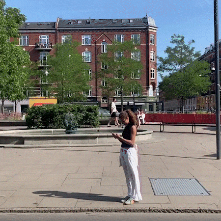
Observe movement
Movement counts help capture who is walking and moving around in the neighbourhood and around food places. Use this method to get a better understanding of how people are using the site today.
Using the Observing Foodscapes app, you will count for five minutes at each location, categorising people counted by perceived gender and age. This will help you begin to form an understanding of the flow of people moving through a public space.
A technical how-to for this method is presented inside the app.
Example FROM THE FIELD
In Copenhagen, young people were counted frequenting public spaces near fast food restaurants more than any other public destination. This led Gehl to tailor intercept surveys to ask why teenagers chose these public spaces and if the relationship to cheap fast food influenced their decision.

Scan the QR code to test this method in the Observing Foodscapes app

Want to test this method in the Observing Foodscapes app? Click here!
Observe stationary activity
Stationary observations help capture who is spending time in public spaces and what are they doing when they choose to stop, stay, and linger. There is a particular focus on observing food consumption and other food related activity in those spaces.
EXAMPLE FROM THE FIELD
In London, 40% of the young people observed were waiting for public transportation – which are almost always next to a big chain fast food restaurant.
Using the Observing Foodscapes app, you will observe people spending time using different activity categories. It’s important to only observe and record people that are not moving, as these are counted while using the Observing Movement method.
A how-to for the methodology, including an overview of all the categories for data collection, is included inside the app.
What do we mean by Stationary Activity?
Below you can see some examples of stationary activity categories you may to encounter in your observations:

Scan the QR code to test this method in the Observing Foodscapes app
Want to test this method in the Observing Foodscapes app? Click here!


Map food places at eye level
Mapping food places at eye level entails recording structured observations of food offerings in the public realm. This method allows you to assess the quality of the built environment as it relates to the food on offer, how vendors interpret demand, and what is possible within a local person's daily routines.
This method is a key step in understanding how the built environment might be encouraging or discouraging certain types of food behaviours.
This method can be used to:
Understand food offerings in the study area (types of food places, what kinds of food are offered)
Record opening hours and times people are able to access food places
Make mobile vendors visible as part of the overall foodscape
Identify visual cues that draw attention to food offerings
Identify price points
Identify physical barriers to access
Identify capacity and availability of seating
A how-to for the methodology is presented inside the app.
EXAMPLE FROM THE FIELD
In Bogota, 75% of the food places observed offered ultra-processed food. This mapping helped the project team ask vendors why ultra-processed food is sold more frequently than nutritious food options, and uncovered unknown barriers to access.

Scan the QR code to test this method in the Observing Foodscapes app
Want to test this method in the Observing Foodscapes app? Click here!
Assess the urban quality
The Urban Quality Assessment will prompt you to evaluate the qualitative, human experience of public spaces and food places.
This method will help you:
Understand the quality of the human experience in a place
Reveal how the spatial conditions might be promoting - or challenging - the ability of people to move through, spend time in, and access or consume food in the place.
EXAMPLE FROM THE FIELD
In Houston, Gehl found that places with the best urban quality were where the most multi-generational groups spent time, indicating where interventions may be most impactful across demographic groups
The Urban Quality Assessment was developed using over 40 years of research on the links between human behaviour and public space quality. See below for a summary of the key variables that the Urban Quality Assessment takes into account:
Click to enlarge.
Scan the QR code to test this method in the Observing Foodscapes app
Want to test this method in the Observing Foodscapes app? Click here!
Record qualitative observations
Quantitative data about public life and food activities is most insightful when paired with qualitative observations registered using your own senses to experience the place and people around you.
The Observing Foodscapes audio guide will help you make qualitative observations about the ways that food places, public space, and public life influence peoples’ behaviour around food in cities.
This audio guide is intended to be listened to with headphones, while in a public space with food places. Bring a notebook and pen to record your observations along the way.

Scan the QR code to test this method in the Observing Foodscapes app
Want to test this method in the Observing Foodscapes app? Click here!